This course is run in conjunction with Night Sailing, Lights and Buoys over one long day.
Navigation for ICC
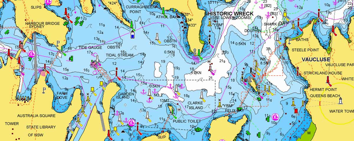
Navigation for ICC is a comprehensive module to give you a good understanding of using Marine Charts, Chart Plotters, iPad Navionics and GPS. It explains why they are different and how they complement each other.
This is for someone who is chartering a yacht or Catamaran for a few days to a few weeks, and will cover the types of situations and information you are likely to need for safety and practical day to day use. It is the essential stepping stone to a more involved Navigation Course.
The course is a one day course and is combined with the Night Sailing course. It is broken up into to three sessions, one class room based and the other two on the water. There is some home work to prepare for the course – comprehensive notes supplied. Finishes around 9:30 pm (10:30 pm daylight saving).
Course includes:
- Chart information, what symbols mean and how to interpret
- Using Latitude and Longitude
- Calculating, distance, speed and time
- Plotting a course
- Allowing for currents and drift
- Using transits
- Taking a bearing
- Using electronic charts including Navionics on iPad
- Understanding AIS on Chartplotters (Identifies commercial vessels and registered recreational vessels)

 Contact Us
By Phone: 0410088028
By email: sales@liquidedge.com.au
Quick Enquiry Form
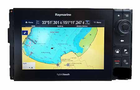
We use the latest touch screen technology by Raymarine and Navionics or Garmin Charts. We relate this back to the traditional paper charts and provide a fast and effective learning outcome to get you from A to B on the water, safely. We also touch on the use of Navionics on iPads or similar.